Balmer Lawn
Starting Point
Tilery Road car park
///prepared.soaps.couch
Standing Hat car park
///juror.teacher.trophy
Distance
6 MILES (10KM) – Circular
Route
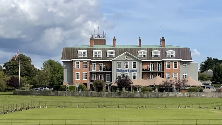
From the Tilery Road car park, follow the road towards the main A337. After passing the popular ‘Brockenhurst Beach’ bathing spot alongside the Lymington River on your left, turn right at the road junction and walk along the roadside path with the imposing Balmer Lawn Hotel on your right.
One of the most familiar buildings in the forest, the hotel was originally built in the mid-1800s as a hunting lodge. It was used as a military hospital during World War One and was a headquarters of the Canadian 3rd Infantry Division in the run-up to D-Day during World War Two.
After you’ve passed the hotel, with the village cricket pitch in front of it, take a right turn into Hollands Wood campsite. Follow the path through the centre of the campsite – the open expanse of Balmer Lawn can be seen though the trees on your right. At the end of the campsite follow the New Forest cycle path into the woodland.
After about 400m follow the path uphill and go through the inclosure gate and follow the path for another 500m as it gently curves to the right. Turn right at the next junction.
Advertisement
After 200m take a left turn and head downhill, then uphill again at Etherise Gutter.
Turn right and walk for 200m until you reach a T-junction opposite the Frohawk Ride. Turn left and after 500m take the path on the left. Continue for 700m until you come to a gate leading on to Beechan Lane.
Turn right and walk another 700m until you reach some open grassland the end of Beechan Lane. Take the path through gate on the right and continue for 250m. Turn left and, after 750m, take a right turn, passing the Frohawk Ride on your right.
After 200m take a left turn at cycle route marker post 286 and continue for 750m until a crossroads in the path. Take the right turn at the crossroads and walk for 300m before turning right again onto the straight path to the edge of Standing Hat Inclosure. Go through the inclosure gate and follow the path back to Tilery Road car park.
Advertisement
View Map
Download GPX
Download PDF Guide
Essential Information
Weather