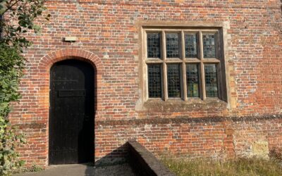
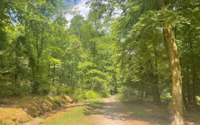
A walk in the New Forest can take you through a patchwork of landscapes and habitats. The national park is Europe’s largest area of lowland heath and boasts 30,000 acres of woodland.
There are special moments of tranquility to savour in ancient woodland, in settings that have changed little in centuries and with only the sounds of the birds and rustling of the undergrowth around you.
Its gently undulating landscape means The New Forest has relatively easy walking trails – many take you along the 100 miles of cycle paths as well as forest paths through woods and across heaths.
A bit of smart planning can help you make the most of the experience while safely and sustainably enjoying the unique environment of the forest.
Check the weather forecast
The great British weather can put the kybosh on a good day out, so check the forecast before you set out.
The south coast tends not to suffer from extremes of weather, but being stuck in a downpour in one of the forest’s open exposed heaths isn’t much fun.
Likewise, make sure you’ve sploshed on the sun cream if you’re walking in the summer months.
Choose a route
There is a wide variety of landscapes throughout the New Forest – a well-chosen route can take in open heathland, ancient forests, picturesque villages – finishing in a traditional New Forest pub or teashop.
It’s best to know where you are going and which paths to follow. A lot of forest paths or tracks for forestry vehicles may look promising, but can end up at a dead end, back where you started or in a muddy quagmire.
It’s not unheard of for people to get stuck in bogs, so knowing your route should help you avoid an embarrassing – or potentially life-threatening – situation with the emergency services.
Of course, we can help you with great ideas for routes – visit our Walks page for our full selection of self-guided walks trails, along with descriptions, GPX tracks and map with live geolocation.
It’s always best to have a back-up map, just incase your battery runs out or you are in an area of poor signal. OS map Explorer 22 covers the New Forest. Buy OS Explorer Maps direct from Ordnance Survey.
What to wear?
Again, the vagaries of the weather will dictate what you’ll wear.
A pair of sturdy, waterproof walking boots is essential. Especially in winter, many paths and forest tracks can become sodden and muddy. While the main gravel paths of the cycle network are accessible, other forest paths are less defined or could have obstructions such as large tree roots or fallen branches.
A rain jacket is another must-have – open areas of heathland can be very exposed to the elements with nowhere to shelter in the event of a downpour. Having several layers mean you can stay warm, but can shed layers if you need to.
In spring and summer months, wear appropriate clothes to avoid tick bites. There’s more tick awareness advice here.
Getting there and away
With the Waterloo – Weymouth South West Mainline cutting through the forest, public transport is a viable option for visiting the New Forest. With stations at Ashurst, Beaulieu Road, Brockenhurst, and Sway, you can start your walk the moment you step off the train.
A branch line connects Brockenhurst and Lymington with connections to Wightlink’s Isle of Wight ferry.
Our Train-to-train walks and bus walks give you the car-free option for getting to the start of your walk route.
There is also the New Forest Tour open top bus which runs a hop-on-hop-off service through July and August with stop offs at popular walking sites.
Bluestar Route 6 runs between Southampton, Lyndhurst, Brockenhurst and Lymington with stops close to walking trails. The 112 Hythe-Lymington service stops at Beaulieu.
Where can I park?
Forestry England manage the network of car parks across the forest. Some of the more popular venues can become full at the height of the holiday seasons, so if you find there are no spaces, the advice is to find another carpark nearby and not park on the verges.
From April 2026, charges for the 129 Forestry England car parks have come into effect:
- Prices start at £1.50 for one hour,
- £3 for 2 hours,
- £5 for 4 hours,
- £8 for more than 4 hours.
- Tickets will be transferrable between all Forestry England car parks in the New Forest – several locations can be used with one payment.
- An annual Forestry England membership will offer unlimited parking for £94 (current price) in all New Forest car parks as well as all Forestry England car parks across the country.
- Payment will be via the Ringo app, website or phoneline and will be permitted up to midnight on the day of parking.
Before you go check if any areas or car parks have been temporarily closed. Car parks and walking trails can be shut for short periods for safety reasons if forestry work is being carried out. Certain car parks are also closed to protect nearby ground-nesting birds at certain times of year – details of all car park closures are on the Forestry England website. Information on walking and cycle route closures can be found here.
Car parks in the villages and on the coast are operated by New Forest District Council. Most are pay and display (seven days a week). Parking clocks are available from New Forest District Council.
Pony drifts
The famous New Forest ponies are rounded up for health and welfare checks between August and November each year. During these drifts, members of the public are advised to avoid the areas where they are taking place for safety reasons. The annual list of pony drift dates and locations is published by the Verderers. Nearby car parks are also closed while the drifts take place – the list of closures is published by Forestry England.
Food and drink
Snacking while walking keeps up your energy levels – bananas, apples, nuts as well as dried fruits like apricots offer a healthy energy boost if needed. Don’t forget to take drinking water with you. Most villages have water refill stations.
Some of our walking routes pass or end at well-known pubs so why not pop in to sample what’s on offer after completing a walk? Look out for the New Forest Marque – the branding used to promote locally-produced food and drink.
In an emergency
In an emergency dial 999 for police, fire, ambulance or coastguard.
To report road traffic accidents involving ponies, cattle, pigs, sheep and donkeys, call the police on 999.
If you come across a sick, injured or dead pony, cow, donkey, pig or sheep (other than a road accident) call 023 8028 2052 during normal office hours, or 0300 067 4600 at other times.
Wildfires pose a major threat to the New Forest’s fragile ecosystems. To report a fire incident, call 999.
Incidents involving deer, wild camping, barbeques, camp fires, fly tipping, wild camping, barbeques BBQs, camp fires, fly tipping, off-road vehicles and unauthorised access to land can be reported to Forestry England on 0300 067 4600.
Use the what3Words app to pinpoint your location for the authorities and emergency services.
Help protect the Forest
The New Forest is is undoubtedly under pressure from the vast numbers of visitors who come to enjoy it each year. The New Forest Code was created with helpful do-s and don’ts for visitors and residents alike.
Following the guidelines when walking – such as sticking to marked tracks and not feeding ponies – will help you make sure you leave behind only the lightest of footprints.