Hale Purlieu
Starting Point
/// reliving.brochure.spinners
Distance
2.5 MILES (4KM) – Circular
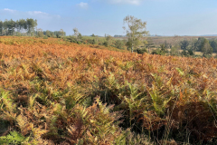
This isolated corner of the forest offers sweeping valley views, windswept trails across the heath and tranquil, meandering streams. Look out for birds such as dartford warblers and stonechats, while birds of prey can perch high on the electricity pylons crossing the purlieu.
Route
Map & GPX
Information
In Pictures
Route
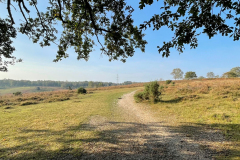
From the car park, take the path heading left in front of a wooden bench. Take in the sweeping views across the valley.
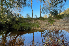
At a fork in the path after 200m, follow the path on the right as it heads gradually downhill towards a small stream at the valley bottom. This has been named Beetles Bottom after a class in Hale’s primary school.
Cross the stream and choose the path on the right which leads steeply up the hill towards a clump of trees. Continue straight as the path plateaus out and turns into grassy track between the ferns and heather.
Advertisement
Follow the path until you meet a junction. Turn left and loop round to the right as the path crosses a stream at the valley bottom. Then turn right onto the path leading back across the other side of the valley.
Continue on the path, keeping an area of cleared woodland at Millersford Copse on your right.
After 800m, turn right on to the track across the cleared woodland, heading downhill towards the stream. Cross the stream and climb up the bank on the other side. Take the path to the left – heading uphill through a tunnel of holly bushes.
At the edge of the inclosure, the path opens out on to the open heathland again. Take the path immediately on the left which skirts open fields.
It leads steeply downhill towards the stream at the valley bottom. Cross the stream and follow the path uphill through the gorse bushes and back to the car park.
Advertisement
View Map
Download GPX
Download PDF Guide
Essential Information
Weather


