Ashurst – Matley Wood
Starting Point
///buyers.doted.eternally
Distance
6 MILES (9KM) – Circular
Categories
Route
Map & GPX
Information
In Pictures
Route
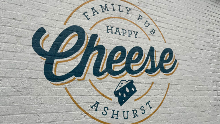
From the small car park beside the NHS Ashurst Centre, follow the road between The Happy Cheese pub and its customers’ car park.
Go through the gate just beyond the pub car park. Follow the gravel path through the trees, with a small area of lawn to your right.
After 350m you’ll reach Church Place Cottage. It is one of the oldest buildings in Ashurst and has been home to the Forest Keepers for generations. Look out for the distinctive deer head trophy mounted on the gable end.
Turn right at the cottage corner, go through the inclosure gate and continue to follow the gravel cycle path for 500m.
When you reach cycle marker post 387, take a left turn and follow the path through Deerleap Inclosure for 1km. Turn right at cycle marker post 385.
Continue straight for 900m until you reach the inclosure gate after cycle marker post 376.
Go through the gate on to the open area of grassland. Take the path to the right at the T-junction ahead of you at cycle marker post 376. Walk through the clump of trees and cross the railway bridge.
After the bridge, the path crosses the Beaulieu River on Fulliford Bog and then forks after a short distance. Take the fork on the right and follow the path for 600m until you reach the edge of Matley Wood.
Continue on the same path for another 1.6km as it gradually heads uphill though the small area of ancient and ornamental woods. At the edge of the trees, pass a barrier and head into the Matley Wood campsite area.
Stay on the main path and turn right opposite a red fire box and head down the bank for 300m with the woods on your right.
Advertisement
To your left is White Moor – an expanse of heathland that extends from Lyndhurst towards Matley Wood and Ashurst. During World War One, White Moor was used as a training site with practise trenches dug to replicate the battlefields in France.
The now-quiet heath would have echoed to the constant sounds of blasts and explosions as soldiers trained with grenades, landmines and mortars. Military dogs were also trained to carry messages through the trenches.
Unexploded items of ordnance have been found on the moor ever since, although systematic search and clearance work in recent years has made it safer. Walkers are still warned to take care if they come across any suspicious objects.
Take the grass path to the right which runs alongside the woods.
After 250m the path enters the edge of the woods. Follow the track as it winds through the trees for 400m. When it emerges from the woods, take the path which heads out over the open heath.
After 150m, just to the left of the path, are the remains of three tumuli – Bronze Age burial mounds. Also known as ‘Barrows’, there are about 200 such mounds in the New Forest. Dating back about 3,500 years, they are thought to be where tribal leaders or other revered individuals were buried.
Continue the short distance until the path joins another track across the heath. Turn left and follow the track for 150m. To your right, the raised area of ground is an ancient earthwork, thought to have been an Iron-Age cattle enclosure.
Walk downhill before crossing the footbridge over the River Beaulieu. Follow the path for another 300m before it bends to the right and then takes a turn to the left and runs uphill alongside the boundary of Ashurst Lodge.
Turn right at the corner of the perimeter of the lodge and walk towards the road. Cross and join the path heading gradually downhill towards the railway line.
Just before the bridge railings, turn left as the path heads through Ashurst Woods back in the direction of the railway line and crosses a small footbridge.
Continue following it through the woods, alongside the railway line on your right, and into the campsite.
Walk through the campsite until you reach the main entrance. A path cuts across the open grass area towards a stile. If you are unable to use a stile, there is a pedestrian gate beside the main cattlegrid entrance on to the main Lyndhurst-Ashurst road.
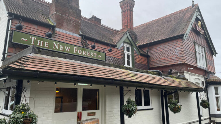
Follow the footpath past the New Forest Pub, back over the railway bridge. Join the road past the parade of shops and the Happy Cheese, towards the car park.
Alternatively, you can cross the railway line footbridge at Ashurst Station (accessed through the New Forest pub car park) and follow the trackside path back towards the car park.
Advertisement
View Map
Download GPX
Download PDF Guide
Essential Information
Weather

Food and Drink
In Pictures


